Grand Ballon-northwest

CyclingUp: Grand Ballon-northwest

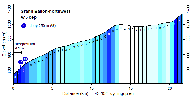
Climbing effort: 475 cep
Elevation meters: 822
Steepest kilometer: 9.1%
Steepest 250 m: 10%
Foot: 550 m Top: 1341 m
Mean slope: 3.6%
Length: 21.7 km
From: Lac de Kruth-Wildenstein
Road conditions (2021): good
Other race bikers: 10-25 per hour
Motor vehicles: >180 per hour
Scenery and road:
Restaurant or bar near top: yes
PHOTOS
W SW SE E NE SIDE Download gpx

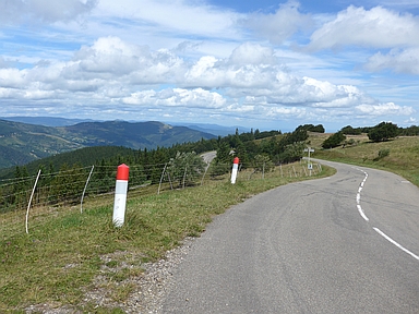
The climb to the Grand Ballon from the northwest can be divided into two parts, namely the route from the Lac de Kruth-Wildenstein to Le Markstein and the continuation on the Route des Crètes to the Grand Ballon. The first part is ideal for racing cyclists, who like a wide road with has such a gentle slope (average 4.2%) that it takes a long time to bridge the difference in altitude. Yet, this part begins with the steepest kilometer of the entire ride (9.1%). The road runs continuously through the forest until, after cycling more than 12 kilometers, one enters into a more open landscape so one gets the reward of views of the neighboring mountains. Many paragliders start their flights here. The second part of the ride, which takes place on the Route des Crètes, offers many views and is easy. The first 6 kilometers run almost horizontally. Only the last, 1400 meter long section from le Haag to the destination of the climb is somewhat harder with a gradient of 7-9%.


Rijd op 22 maart deze prachtige tocht over de Veluwe, 75 of 125 kilometer vanuit Wageningen. Met veel hoogtemeters: resp. 550 en 970. Inschrijving
1K Ride
Rijd op 15 juni deze tocht met meer dan 1000 hoogtemeters; 80, 120 of 145 kilometer vanuit Oosterbeek. Inschrijving
Tour for Life
Rijdt deze zomer de unieke en klassieke 8-daagse wielrentocht van Noord-Italië naar Zuid-Nederland voor Artsen zonder Grenzen!

