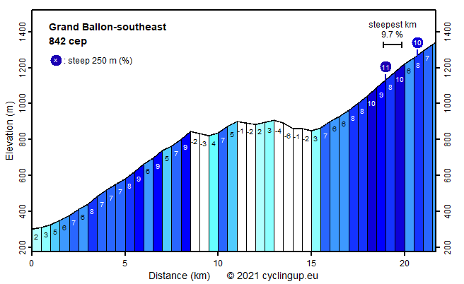
Grand Ballon-southeast

CyclingUp: Grand Ballon-southeast

Climbing effort: 842 cep
Elevation meters: 1161
Steepest kilometer: 9.7%
Steepest 250 m: 11%
Foot: 299 m Top: 1341 m
Mean slope: 4.8%
Length: 21.7 km
From: Uffholtz
Road conditions (2021): good
Other race bikers: 10-25 per hour
Motor vehicles: 60-180 per hour
Scenery and road:
Restaurant or bar near top: yes
PHOTOS
W SW NE E NW SIDE Download gpx

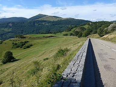
With 842 climb effort points this ascent from Uffholtz to the Grand Ballon is the toughest climb in the Vosges on this website. There are two reasons. The first are the elevation meters, no less than 1161. This high number is partly due to the fact that halfway the ride, over the last seven kilometers before the Col Amic, 119 elevation meters are lost in some descents, which then have to be climbed again further on. The second reason is the relatively steep part between the Col Amic and the destination of the ride, which is 6.5 kilometers long with an average gradient of 8.0% and a steepest kilometer of 9.7%. The tour takes entirely place on the Route des Crètes, of which Uffholtz forms the southernmost point. The first two kilometers are easy (2-6%) but over the following 6.5 kilometers the road runs moderately steeply (5-9%) uphill. Next comes the already mentioned middle part with its descents. Over the last of these ending at the Col Amic there are wonderful views, dominated by the highest part of the Grand Ballon. Then there is the already mentioned relatively steep final part. First its surroundings consist of dense forests but during the final 3 kilometers these give way to the more open landscape of the highest parts of the Vosges, allowing wide views. The finish is some 80 meters below the highest point of the Vosges (1424 m).


Rijd op 22 maart deze prachtige tocht over de Veluwe, 75 of 125 kilometer vanuit Wageningen. Met veel hoogtemeters: resp. 550 en 970. Inschrijving
1K Ride
Rijd op 15 juni deze tocht met meer dan 1000 hoogtemeters; 80, 120 of 145 kilometer vanuit Oosterbeek. Inschrijving
Tour for Life
Rijdt deze zomer de unieke en klassieke 8-daagse wielrentocht van Noord-Italië naar Zuid-Nederland voor Artsen zonder Grenzen!

