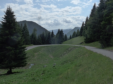
Passo Brocon-southwest

CyclingUp: Passo Brocon-southwest

Climbing effort: 1057 cep
Elevation meters: 1382
Steepest kilometer: 11.5%
Steepest 250 m: 13%
Foot: 353 m Top: 1615 m
Mean slope: 4.7%
Length: 26.7 km
From: Strigno
Road conditions (2021): moderate
Other race bikers: 0-1 per hour
Motor vehicles: 10-30 per hour
Scenery and road:
Restaurant or bar near top: yes
PHOTOS
S SE N SIDE Download gpx

The ascent from Strigno to the Passo Brocon is long (26.7 kilometers) and varied. It starts at the exit to Strigno from the main road through the Valsugana (SS47). The first 2.5 kilometers to Strigno are relatively easy (3-6%). Then, for the next 5 kilometers, the road winds uphill to Bieno and is a little steeper (mostly 7-8%). At Bieno you get to the so-called Altiplano (plateau) Tesino-Bieno and as the term plateau promises in the next five kilometers to Pieve Tesino the road hardly gains elevation. From the start until Pieve Tesino there is quite some traffic. Hence, one might consider replacing this part of the climb with the first part of the climb to the Brocon from Grigno, which is a much quieter and nicer route. In that case you would have to deviate from that route in Castello Tesino and follow the signs to Pieve Tesino, where you then meet the route described here. From Pieve Tesino one continues northward into the Valmalene, where there is much less traffic. First one cycles five kilometers through the valley (0-9%). Then, in a hairpin bend just after the campsite the most exciting part of the ascent begins, certainly for the real climber. The next seven 500 meter segments slope 8-12%. Here the street is narrow and you will hardly see cars. In the forest the road winds uphill with many bends and hairpin bends. After this steep section a little more than 3 kilometers remain to the pass. These are almost horizontal.


Rijd op 22 maart deze prachtige tocht over de Veluwe, 75 of 125 kilometer vanuit Wageningen. Met veel hoogtemeters: resp. 550 en 970. Inschrijving
1K Ride
Rijd op 15 juni deze tocht met meer dan 1000 hoogtemeters; 80, 120 of 145 kilometer vanuit Oosterbeek. Inschrijving
Tour for Life
Rijdt deze zomer de unieke en klassieke 8-daagse wielrentocht van Noord-Italië naar Zuid-Nederland voor Artsen zonder Grenzen!

