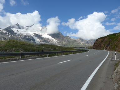
Berninapass-south

CyclingUp: Berninapass-south

Climbing effort: 1044 cep
Elevation meters: 1309
Steepest kilometer: 9.1%
Steepest 250 m: 11%
Foot: 1019 m Top: 2328 m
Mean slope: 7.5%
Length: 17.5 km
From: Poschiavo
Road conditions (2016): good
Other race bikers: 10-25 per hour
Motor vehicles: 60-180 per hour
Scenery and road:
Restaurant or bar near top: yes
PHOTOS VIDEO
NW SIDE Download gpx

The climb from the south to the Berninapass is quite an effort due to the large difference in altitude (1309 m) between Poschiavo and the pass and due to the slope, which ranges almost during the entire trip between 7 and 9%. Still, this is not one of my favourite passes. The landscape is not really special, and the road is wide and quite busy with traffic, including a lot of trucks. Besides, really exciting or very steep passages are missing. The steepest kilometer has a slope of 9.1%. The Berninapass is the only connection between the Val di Poschiavo, which is part of the Swiss territory, and the rest of Switzerland. In the Val di Poschiavo Italian is spoken, On the other side of the pass, in the Oberengadin, Romansh and German. The ride begins at the bridge across the brook on the north side of Poschiavo. After two easy kilometers (4-5%) the real ascent begins at the end of San Carlo. On the remaining 15.5 kilometers the slope measures almost always 7-9%. There are short moments to relax at La Rösa (at an altitude of 1871 meters) and in the mostly wide turns of the road.


Rijd op 22 maart deze prachtige tocht over de Veluwe, 75 of 125 kilometer vanuit Wageningen. Met veel hoogtemeters: resp. 550 en 970. Inschrijving
1K Ride
Rijd op 15 juni deze tocht met meer dan 1000 hoogtemeters; 80, 120 of 145 kilometer vanuit Oosterbeek. Inschrijving
Tour for Life
Rijdt deze zomer de unieke en klassieke 8-daagse wielrentocht van Noord-Italië naar Zuid-Nederland voor Artsen zonder Grenzen!

