HOME cyclingup.eu

regions

method
contact
links
French Alps
Switzerland
Austria
Italian Alps
French Pyrenees
Spain
Gran Canaria
Vosges
Black Forest
Brocken, Germany
Ardennes
Netherlands
Passo di San Antonio-south
CyclingUp: Passo di San Antonio-south
Climbing effort: 585 cep
Elevation meters: 642
Steepest kilometer: 11.3%
Steepest 250 m: 13%
Foot: 845 m Top: 1476 m
Mean slope: 7.5%
Length: 8.5 km
From: Auronzo_di_Cadore
Road conditions (2017): average
Other race bikers: 5-10 per hour
Motor vehicles: 30-60 per hour
Scenery and road:
Restaurant or bar near top: no
PHOTOS
E SIDE Download gpx
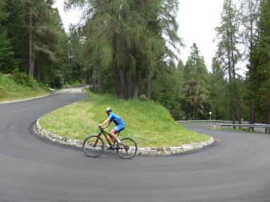

This climb to the Passo di San Antonio, also called Passo del Zovo, from Auronzo is not really easy. Although the number of elevation meters is limited to only 642, the road contains a long and steep section. Between kilometer one and seven all five-hundred-meter intervals have a slope of 9 or 10% (9.5% on average). Within this steep part, more exactly after the second hairpin bend, also lies the steepest 250 meter section of the ride (13%). Thanks to the total of sixteen hairpin bends, the ride is certainly not boring. However, views are scarce because almost the whole trip takes place in the forest. During the final, easy, one and a half kilometers the road runs up and down alternatingly.
Veluviatocht
Rijd op 21 maart deze prachtige tocht vanuit Wageningen over de Veluwe. Keuze uit 80 en 125 km met resp. 580 en 990 hoogtemeters. Inschrijving vanaf 31 december
Tour for Life
Rijdt deze zomer de unieke en klassieke 8-daagse wielrentocht van Noord-Italië naar Zuid-Nederland voor Artsen zonder Grenzen!