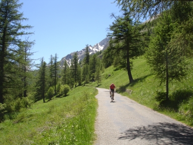
Col de la Cayolle-north

CyclingUp: Col de la Cayolle-north

Climbing effort: 642 cep
Elevation meters: 1200
Steepest kilometer: 7.6%
Steepest 250 m: 9%
Foot: 1138 m Top: 2326 m
Mean slope: 4.3%
Length: 27.3 km
From: Barcelonnette
Road conditions (2013): average
Other race bikers: 5-10 per hour
Motor vehicles: 10-30 per hour
Scenery and road:
Restaurant or bar near top: no
PHOTOS
S SIDE Download gpx

This col is utterly suitable for race bikers: nature is splendid and varied, there is not much motorised traffic on the generally narrow road, road conditions are reasonable. Nowhere the slope of the 500 meter intervals exceeds 7%. My profile starts where the road to the Col d'Allos splits from the route to the Col de la Cayolle, ~2 km from Barcelonnette. The first ~20 km are easy, with the slope only incidentally exceeding 5%. Sonn after the beginning the road enters the Gorges du Bachelard and bends to the east. Then the valley widens and at Bayasse (1783 m) the climb becomes somewhat more serious. I found this the most beautiful part of the tour, due to the open forest consisting mainly of larches and the views, to the west, on Mount Pelat (3051 m). The final part of the climb is rather barren.


Rijd op 30 augustus deze prachtige klimtocht vanuit Wageningen over de Veluwe, door Montferland, Reichswald en Rijk van Nijmegen. Keuze uit 105 en 155 km met resp. 750 en 1130 hoogtemeters. Inschrijven vanaf 22 juni
Tour for Life
Rijdt deze zomer de unieke en klassieke 8-daagse wielrentocht van Noord-Italië naar Zuid-Nederland voor Artsen zonder Grenzen!

