Eduardshöhe-northwest

CyclingUp: Eduardshöhe-northwest

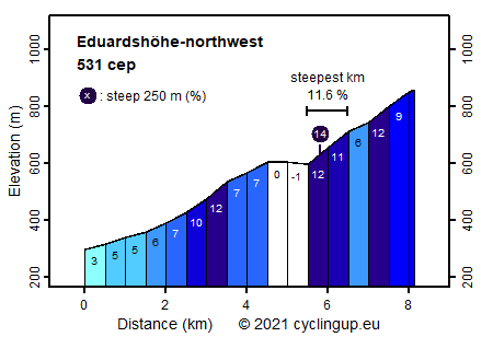
Climbing effort: 531 cep
Elevation meters: 585
Steepest kilometer: 11.6%
Steepest 250 m: 14%
Foot: 295 m Top: 859 m
Mean slope: 6.9%
Length: 8.1 km
From: Au
Road conditions (2015): good
Other race bikers: 0-1 per hour
Motor vehicles: 10-30 per hour
Scenery and road:
Restaurant or bar near top: no
PHOTOS
N SIDE Download gpx

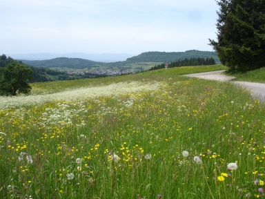
Since this climb hardly leads through the forest, it is not a typical Black Forest climb. In the open landscape one can enjoy meadows full of flowers and views on the surrounding hills, Freiburg and the Vosges. We begin in Au where the Waldstrasse meets the L122 and take the L122 five hundred meters to the south. Then, following the sign Horben, we turn left into the Katzental. In this beautiful valley we leave the noise of the city behind us. Two kilometers further we turn sharply to the left and begin with the most beautiful part of the trip. Biking also gets hard here. First, the slope is 10%. Then, heading for a ridge straight ahead, the slope increases to some 12%. On top of the ridge lies the village of Langackern. There we turn right and drive easily to Horben. Upon leaving this last village, a very steep section (a kilometer of 11.6%) begins. On passing the Buckhof one can relax a little, before going into the tough (average slope 10%) final one and a half kilometers. Here the road is inaccessible to cars.


Rijd op 22 maart deze prachtige tocht over de Veluwe, 75 of 125 kilometer vanuit Wageningen. Met veel hoogtemeters: resp. 550 en 970. Inschrijving
1K Ride
Rijd op 15 juni deze tocht met meer dan 1000 hoogtemeters; 80, 120 of 145 kilometer vanuit Oosterbeek. Inschrijving
Tour for Life
Rijdt deze zomer de unieke en klassieke 8-daagse wielrentocht van Noord-Italië naar Zuid-Nederland voor Artsen zonder Grenzen!

