Pillerhöhe-northeast

CyclingUp: Pillerhöhe-northeast

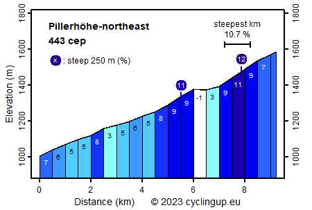
Climbing effort: 443 cep
Elevation meters: 595
Steepest kilometer: 10.7%
Steepest 250 m: 12%
Foot: 1004 m Top: 1585 m
Mean slope: 6.3%
Length: 9.2 km
From: Wenns
Road conditions (2019): good
Other race bikers: 5-10 per hour
Motor vehicles: >180 per hour
Scenery and road:
Restaurant or bar near top: yes
PHOTOS
S W SIDE Download gpx

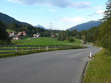
The Pillerhöhe is the only driveable mountain pass joining the Pitztal with the Kaunertal. In addition, one may reach the Pillerhöhe from the Inn Valley. Among the three ascents to the Pillerhöhe, the ride of this page, starting from Wenns in the Pitztal, is the busiest and the easiest. It is suitable as a training tour (595 elevation meters) for tougher challenges. The first five kilometers (3-8%) are hardly remarkable. This is followed by a steeper kilometer in the village of Piller (9%) and then by an almost horizontal kilometer. The most exciting are the last two kilometers where the road crosses a dense forest and which include the steepest kilometer of the climb (10.7%). Turn left at a fork (the Pillerhöhe itself). The culmination point and thus the destination is located more than 200 meters further at the foot of the Naturparkhaus Kaunergrat. It is worth walking to the viewpoint located slightly lower down to look into the steep and deep Inn Valley.


Rijd op 22 maart deze prachtige tocht over de Veluwe, 75 of 125 kilometer vanuit Wageningen. Met veel hoogtemeters: resp. 550 en 970. Inschrijving
1K Ride
Rijd op 15 juni deze tocht met meer dan 1000 hoogtemeters; 80, 120 of 145 kilometer vanuit Oosterbeek. Inschrijving
Tour for Life
Rijdt deze zomer de unieke en klassieke 8-daagse wielrentocht van Noord-Italië naar Zuid-Nederland voor Artsen zonder Grenzen!

