Eisentalhöhe-southeast

CyclingUp: Eisentalhöhe-southeast

Climbing effort: 462 cep
Elevation meters: 514
Steepest kilometer: 10.9%
Steepest 250 m: 13%
Foot: 1533 m Top: 2042 m
Mean slope: 7.9%
Length: 6.4 km
From: Sackelalm
Road conditions (2019): good
Other race bikers: 5-10 per hour
Motor vehicles: 60-180 per hour
Scenery and road:
Restaurant or bar near top: yes
PHOTOS
NW SIDE Download gpx

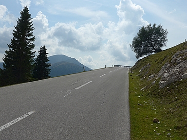
This ascent to the Eisentalhöhe is part of the Nockalmstraße, a tourist attraction. In my opinion it's a pretty nice road but I've seen better ones. The road is not really calm and loved by motorcyclists. The surrounding area is full of nature but not spectacular. The road is wide and hardly anywhere particularly steep. The Nockalmstraße includes two passes and lacks significant side streets. The lowest point between the two passes is located at the Sackelalm. The ascent of this web page begins at this alm with a 500 meter interval of 11%. However, the road soon flattens and even a short descent (5 elevation meters) is encountered. After a total of 2.5 kilometers, after a hairpin bend to the left, the asphalt gets steep again, which sets the tone for the remaining 4 kilometers to the pass. The slope fluctuates between 8 and 11% with a steepest kilometer of 10.9% halfway. For me, this climb was the most pleasant part of the Nockalmstrasse because it is varied here thanks to the many curves and because there are quite some nice views.


Rijd op 22 maart deze prachtige tocht over de Veluwe, 75 of 125 kilometer vanuit Wageningen. Met veel hoogtemeters: resp. 550 en 970. Inschrijving
1K Ride
Rijd op 15 juni deze tocht met meer dan 1000 hoogtemeters; 80, 120 of 145 kilometer vanuit Oosterbeek. Inschrijving
Tour for Life
Rijdt deze zomer de unieke en klassieke 8-daagse wielrentocht van Noord-Italië naar Zuid-Nederland voor Artsen zonder Grenzen!

