
Ruhestein-south
CyclingUp: Ruhestein-south
Climbing effort: 392 cep
Elevation meters: 673
Steepest kilometer: 9.3%
Steepest 250 m: 11%
Foot: 290 m Top: 910 m
Mean slope: 3.3%
Length: 18.7 km
From: Oppenau
Road conditions (2016): good
Other race bikers: 1-5 per hour
Motor vehicles: 60-180 per hour
Scenery and road:
Restaurant or bar near top: yes
PHOTOS VIDEO
W SIDE Download gpx
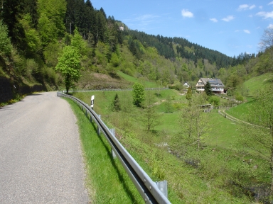

The climb from Oppenau to Ruhestein covers a relatively long distance (19 kilometers) and runs mainly through the Lierbachtal. The slope is easy but there are two exceptions. The first steep section (7-9%) starts at the parking lot of the Allerheiligen falls after seven kilometers of cycling and ends two kilometers further on. After that steep section follows a descent and about one and a half kilometers further on Allerheiligen is reached. This place consists of ruins of a monastery and forms a tourist attraction. After Allerheiligen the road starts to climb again up to the fork of the roads to Ottenhöfen and Ruhestein. We head for Ruhestein. First, 13 elevation meters are lost in a descent. After crossing a brook, one continues with the steepest kilometer of the entire climb (9.3%). The ride is completed with a stretch of more than five kilometers with a gentle slope (mostly 2%) until the Schwarzwaldhochstraße is reached at Ruhestein.
Rijd op 22 maart deze prachtige tocht over de Veluwe, 75 of 125 kilometer vanuit Wageningen. Met veel hoogtemeters: resp. 550 en 970. Inschrijving
1K Ride
Rijd op 15 juni deze tocht met meer dan 1000 hoogtemeters; 80, 120 of 145 kilometer vanuit Oosterbeek. Inschrijving
Tour for Life
Rijdt deze zomer de unieke en klassieke 8-daagse wielrentocht van Noord-Italië naar Zuid-Nederland voor Artsen zonder Grenzen!