
Kandel-south
CyclingUp: Kandel-south
Climbing effort: 593 cep
Elevation meters: 860
Steepest kilometer: 10.2%
Steepest 250 m: 12%
Foot: 420 m Top: 1205 m
Mean slope: 5.0%
Length: 15.9 km
From: Eschbach
Road conditions (2015): average
Other race bikers: 5-10 per hour
Motor vehicles: 10-30 per hour
Scenery and road:
Restaurant or bar near top: yes
PHOTOS
N SIDE Download gpx
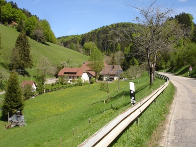

This climb is characterized by a lot of variety in slope angle, especially in the second part. However, none of the 500 meter intervals is steeper than 10%. The first five kilometers of the ride take place in the valley of the Eschbach. The beginning is in the village bearing this name, at the side road to Hintereschbach. The road is sloping, though not really steep. In this part the maximum reaches 7% after the two hairpin bends. After five kilometers one gets to the village of St. Peter, which is dominated by the former monastery of the same name. At the end of the village one turns left towards the Glottertal and a descent with an elevation loss of 75 meters follows. Then one needs to turn to the right onto the L186 in the direction of Kandel. The road is much more quiet now. First you drive past some meadows and the village of Sägendobel that lies in the valley below. Then the road enters into the forest where it stays until shortly before the finish. In this section the slope is constantly changing. Two parts of one kilometer have a slope of 10% but there are also a short, almost horizontal section. The pass offers a wonderful view of the Vosges and the Kaiserstuhl.
Rijd op 22 maart deze prachtige tocht over de Veluwe, 75 of 125 kilometer vanuit Wageningen. Met veel hoogtemeters: resp. 550 en 970. Inschrijving
1K Ride
Rijd op 15 juni deze tocht met meer dan 1000 hoogtemeters; 80, 120 of 145 kilometer vanuit Oosterbeek. Inschrijving
Tour for Life
Rijdt deze zomer de unieke en klassieke 8-daagse wielrentocht van Noord-Italië naar Zuid-Nederland voor Artsen zonder Grenzen!