Furkajoch-west

CyclingUp: Furkajoch-west

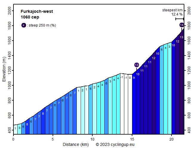
Climbing effort: 1060 cep
Elevation meters: 1304
Steepest kilometer: 12.4%
Steepest 250 m: 14%
Foot: 470 m Top: 1759 m
Mean slope: 6.0%
Length: 21.6 km
From: Rangweil
Road conditions (2020): good
Other race bikers: 5-10 per hour
Motor vehicles: >180 per hour
Scenery and road:
Restaurant or bar near top: yes
PHOTOS Download gpx

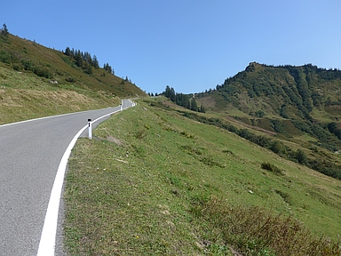
The ascent from Rankweil to the Furkajoch is not surrounded by the highest mountains but the landscape is quite beautiful, very green and steep. If possible, don't cycle here on a beautiful Sunday because then the road is full of motorcycles and cars. The first eight kilometers up to the end of the houses of Laterns-Thal are not very exciting and mostly have a gradient of about 7%. In this section there are two approximately 500 meters long, well-lit tunnels. The first one can be bypassed on a closed old road. Unfortunately, this does not work for the second tunnel. The next seven kilometers are easy (average 2.5%). In the middle of this section, past Innerlaterns, the road, which has been wide until this point, becomes narrower and therefore more exciting. This is perhaps the most scenic part of the ride. It's also the calm before the storm because the next three and a half kilometers are really steep (on average 10.7%). In this part the road is winding up through the forest. When leaving the forest, the ride becomes a little easier (1.5 kilometers of 3-5%). After a turn to the left, however, there is a really tough final section of a kilometer and a half. In the barren landscape it is difficult to see that the road is very steep here. The last kilometer before the pass tilts 12.4%.


Rijd op 22 maart deze prachtige tocht over de Veluwe, 75 of 125 kilometer vanuit Wageningen. Met veel hoogtemeters: resp. 550 en 970. Inschrijving
1K Ride
Rijd op 15 juni deze tocht met meer dan 1000 hoogtemeters; 80, 120 of 145 kilometer vanuit Oosterbeek. Inschrijving
Tour for Life
Rijdt deze zomer de unieke en klassieke 8-daagse wielrentocht van Noord-Italië naar Zuid-Nederland voor Artsen zonder Grenzen!

