Col de Bramont-south

CyclingUp: Col de Bramont-south

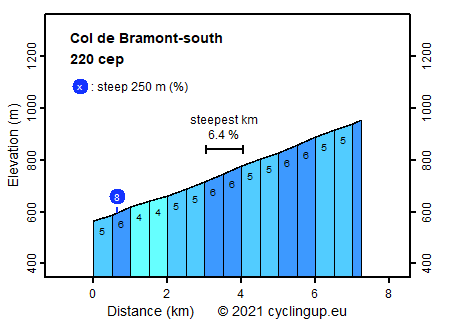
Climbing effort: 220 cep
Elevation meters: 391
Steepest kilometer: 6.4%
Steepest 250 m: 8%
Foot: 565 m Top: 956 m
Mean slope: 5.4%
Length: 7.3 km
From: Wildenstein
Road conditions (2014): good
Other race bikers: 10-25 per hour
Motor vehicles: 30-60 per hour
Scenery and road:
Restaurant or bar near top: no
PHOTOS Download gpx

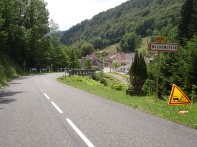
This is not a very difficult ascent with only 220 climb effort points, 391 meters to climb and a maximum slope of 6% for the 500 meter intervals. However, it is a pleasure to cycle it up mainly because of the 14 hairpin bends and perhaps also, if you like it, because the slope is almost constant. You may also encounter quite some other cyclists here since this col constitutes the connection between the Vallée de Vologne in the north and the Vallée de la Thur in the south. The sides of the road are densely forested, so views on the Vallée de la Thur are rare, at least in summer. The beginning of the trip presented here lies near the church of the village of Wildenstein.


Veluviatocht
Rijd op 22 maart deze prachtige tocht over de Veluwe, 75 of 125 kilometer vanuit Wageningen. Met veel hoogtemeters: resp. 550 en 970. Inschrijving
1K Ride
Rijd op 15 juni deze tocht met meer dan 1000 hoogtemeters; 80, 120 of 145 kilometer vanuit Oosterbeek. Inschrijving
Tour for Life
Rijdt deze zomer de unieke en klassieke 8-daagse wielrentocht van Noord-Italië naar Zuid-Nederland voor Artsen zonder Grenzen!

