HOME cyclingup.eu

regions

method
contact
links
French Alps
Switzerland
Austria
Italian Alps
French Pyrenees
Spain
Gran Canaria
Vosges
Black Forest
Brocken, Germany
Ardennes
Netherlands
Puerto de Panderruedas-southwest
CyclingUp: Puerto de Panderruedas-southwest
Climbing effort: 158 cep
Elevation meters: 355
Steepest kilometer: 7.3%
Steepest 250 m: 8%
Foot: 1116 m Top: 1463 m
Mean slope: 3.0%
Length: 11.4 km
From: Vegacerneja
Road conditions (2022): average
Other race bikers: 1-5 per hour
Motor vehicles: 10-30 per hour
Scenery and road:
Restaurant or bar near top: no
PHOTOS
NE SIDE Download gpx
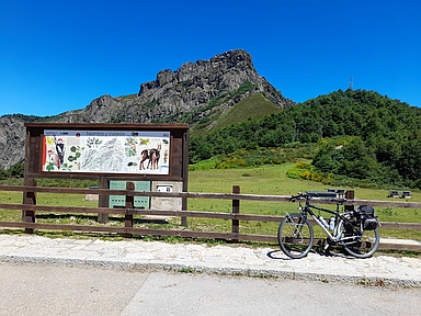
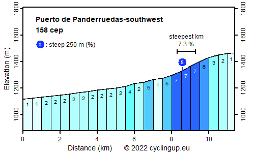
This ride to the Puerto de Panderruedas begins in Vegacerneja, which lies a little north of the Embalse de Riaño. With only 158 climb effort points and 355 meters in altitude this is an easy climb. Over the first 7 kilometers, when we head in the direction of the Puerto del Pontón on the national road, the elevation gain is very small (average 2.1%). At the turnoff towards the Panderruedas 4,5 kilometer remain tot the pass. These are a little steeper, with a steepest kilometer of 7.3%, than before the turnoff. First the road leads through the forest, so views are rare but gradually more views of the surrounding mountains emerge. At the pass itself two magnificent mountain massifs of the Picos de Europa dominate the sight.
intoAsturias
For tours in the splendid and varied nature of Asturias.
Grazalema Cycling Adventures offers guided bike tours and rents road, mountain and electric bikes in splendid Andalusia.
Camping Alpujarras in Laroles, along the road to the Puerto de la Ragua, offers superb views, green grass, good meals and great hospitality.
Veluviatocht
Rijd op 21 maart deze prachtige tocht vanuit Wageningen over de Veluwe. Keuze uit 80 en 125 km met resp. 580 en 990 hoogtemeters. Inschrijving vanaf 31 december
Tour for Life
Rijdt deze zomer de unieke en klassieke 8-daagse wielrentocht van Noord-Italië naar Zuid-Nederland voor Artsen zonder Grenzen!