


-south

CyclingUp: -south

Climbing effort: cep
Elevation meters:
Steepest kilometer: %
Steepest 250 m: %
Foot: m Top: m
Mean slope: %
Length: km
From:
Road conditions ():
Other race bikers: per hour
Motor vehicles: per hour
Scenery and road:
 (/5)
(/5) Restaurant or bar near top:
PHOTOS VIDEO Download gpx
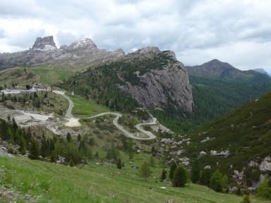
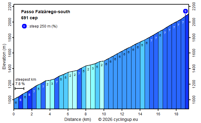
The ascent to the Passo Falzàrego from Caprile is quite boring. The Falzàrego is much less interesting than the Passo di Giau, which, just like the Falzàrego, connects Caprile with Cortina d'Ampezzo. The road of the southern ascent is wide, is more busy than the road to the Giau, offers relatively few views and is nowhere really steep. The steepest kilometer has a slope of only 7.7% and is found immediately after the start in Caprile. After that, the next nine kilometers, up to where one gets to road SR48 in Cernadoi, are easy with a slope between 2 and 8%. Sometimes there are nice views of the Sella Group (left front), of the Marmolada (on the left) and of Monte Civetta (on the back). The remaining ten kilometers from Cernadoi to the pass may almost all be cycled with the same gear because the inclination is almost everywhere 6-7%.
Rijd op 29 augustus deze prachtige klimtocht vanuit Wageningen over de Veluwe, door Montferland, Reichswald en Rijk van Nijmegen. Keuze uit 105 en 155 km met resp. 800 en 1180 hoogtemeters. Inschrijving vanaf nu
Tour for Life
Rijdt deze zomer de unieke en klassieke 8-daagse wielrentocht van Noord-Italië naar Zuid-Nederland voor Artsen zonder Grenzen!