
Zuflucht-west
CyclingUp: Zuflucht-west
Climbing effort: 640 cep
Elevation meters: 670
Steepest kilometer: 12.6%
Steepest 250 m: 15%
Foot: 290 m Top: 960 m
Mean slope: 8.6%
Length: 7.8 km
From: Oppenau
Road conditions (2016): excellent
Other race bikers: 0-1 per hour
Motor vehicles: >180 per hour
Scenery and road:
Restaurant or bar near top: yes
PHOTOS VIDEO
SW SIDE Download gpx
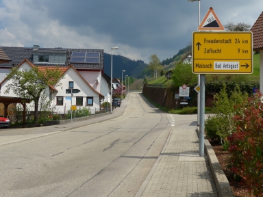

The ascent from Oppenau to Zuflucht is quite hard. Altogether 670 elevation meters must be bridged, the road is almost everywhere steep (at least 8%) and some parts are really steep. The profile includes as many as four 250 meter sections of 12-15%. The steepest kilometer (12.6%) is found after six kilometers, just before a ninety-degree curve to the right. The ride begins at the eastern outskirts of Oppenau, at the fork of the roads to Allerheiligen and Zuflucht. Soon you will see a road sign warning against a slope of 18%. Fortunately, this is an exaggeration. After a little more than a kilometer the quite busy road with almost perfect asphalt enters into the forest. This does not change for some distance, so there are hardly any views. An exception is the view from the parking lot at the end of the steep part of the climb, where paragliders start their flights. After this parking lot the slope of the road is barely noticeable (1%), making the remaining 500 meters to the highest point just before Hotel Zuflucht easy.
Rijd op 21 maart deze prachtige tocht vanuit Wageningen over de Veluwe. Keuze uit 80 en 125 km met resp. 580 en 990 hoogtemeters. Inschrijving vanaf 31 december
Tour for Life
Rijdt deze zomer de unieke en klassieke 8-daagse wielrentocht van Noord-Italië naar Zuid-Nederland voor Artsen zonder Grenzen!