Wiedener Eck-southeast

CyclingUp: Wiedener Eck-southeast

Climbing effort: 223 cep
Elevation meters: 474
Steepest kilometer: 5.9%
Steepest 250 m: 7%
Foot: 561 m Top: 1035 m
Mean slope: 4.5%
Length: 10.5 km
From: Utzenfeld
Road conditions (2017): good
Other race bikers: 0-1 per hour
Motor vehicles: 30-60 per hour
Scenery and road:
Restaurant or bar near top: yes
PHOTOS Download gpx

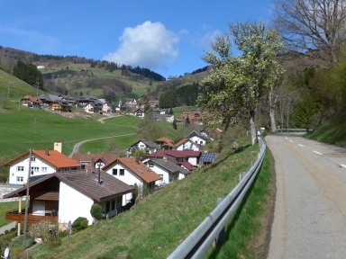
The ascent to Wiedener Eck from Utzenfeld in the Wiesental is beautiful and the road is surprisingly quiet. I liked the landscape, especially the first part through the valley of the Wiedenbach and before entering the first part of Wieden, called Säge. This is a relaxed climb, mainly because the slope of the 500 meter intervals nowhere exceeds 6%. I could complete the whole distance using only the middle chainring, which is, during the ascents of this site, exceptional for me. The number of elevation meters (474) is also limited.


Veluviatocht
Rijd op 22 maart deze prachtige tocht over de Veluwe, 75 of 125 kilometer vanuit Wageningen. Met veel hoogtemeters: resp. 550 en 970. Inschrijving
1K Ride
Rijd op 15 juni deze tocht met meer dan 1000 hoogtemeters; 80, 120 of 145 kilometer vanuit Oosterbeek. Inschrijving
Tour for Life
Rijdt deze zomer de unieke en klassieke 8-daagse wielrentocht van Noord-Italië naar Zuid-Nederland voor Artsen zonder Grenzen!

