
Hochblauen-south
CyclingUp: Hochblauen-south
Climbing effort: 519 cep
Elevation meters: 812
Steepest kilometer: 9.6%
Steepest 250 m: 11%
Foot: 370 m Top: 1160 m
Mean slope: 4.8%
Length: 16.4 km
From: Kandern
Road conditions (2017): good
Other race bikers: 5-10 per hour
Motor vehicles: 60-180 per hour
Scenery and road:
Restaurant or bar near top: no
PHOTOS
NW SIDE Download gpx
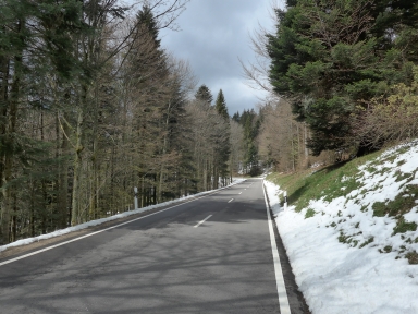

From Kandern the ascent to the Hochblauen is easier (519 climb effort points or cep ) than from Badenweiler (683 cep). On the first eight kilometers up to Malsburg-Marzell the road is nowhere steeper than 6%. What follows is the steepest kilometer of the trip (9.6%), which ends at a fork where we turn left. Up to here the road ran through the valley of the Kander and it is surrounded by meadows and forests. After the fork of the road, forests predominate. A short descent, leading to a loss of 22 elevation meters, follows. At the next bifurcation, we turn left again. The remaining three kilometers are hard (7-9%) again. The reward at the summit may, if atmospheric conditions allow, be a superb view, which can be enjoyed most from the small tower at the very top of Hochblauen. Due to its position in the uttermost south-west corner of the Black Forest, the view embaces the Vosges, the Rhine Valley with Basel, the Jura and the Alps.
Rijd op 22 maart deze prachtige tocht over de Veluwe, 75 of 125 kilometer vanuit Wageningen. Met veel hoogtemeters: resp. 550 en 970. Inschrijving
1K Ride
Rijd op 15 juni deze tocht met meer dan 1000 hoogtemeters; 80, 120 of 145 kilometer vanuit Oosterbeek. Inschrijving
Tour for Life
Rijdt deze zomer de unieke en klassieke 8-daagse wielrentocht van Noord-Italië naar Zuid-Nederland voor Artsen zonder Grenzen!