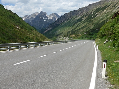
Arlbergpass-west

CyclingUp: Arlbergpass-west

Climbing effort: 503 cep
Elevation meters: 730
Steepest kilometer: 9.2%
Steepest 250 m: 12%
Foot: 1073 m Top: 1793 m
Mean slope: 6.1%
Length: 11.7 km
From: Klösterle
Road conditions (2021): good
Other race bikers: 1-5 per hour
Motor vehicles: 60-180 per hour
Scenery and road:
Restaurant or bar near top: yes
PHOTOS Download gpx

The Arlbergpass and especially the tunnels underneath are important links in the Austrian road and railway network because they connect Vorarlberg with the rest of the country. If you drive from Voralberg to the pass, the road starts to slope significantly in Klösterle, where the ascent of this web page begins. Shortly after Klösterly there are three tunnels. In the first there is a kind of bike path and it is not allowed to bypass the second on the outside. In the third, cycling is prohibited but there is a nice bike path outside with fresh air. After more than five kilometers cycling, the village of Stuben is reached and a steeper section with 9 bends follows (two and a half kilometers with an average slope of 8.2%). This part ends where the road to the Flexenpass turns off. Shortly after the fork, the road descends 10 elevation meters. After that still three moderately steep (4-7%) kilometers remain up to the pass.


Rijd op 22 maart deze prachtige tocht over de Veluwe, 75 of 125 kilometer vanuit Wageningen. Met veel hoogtemeters: resp. 550 en 970. Inschrijving
1K Ride
Rijd op 15 juni deze tocht met meer dan 1000 hoogtemeters; 80, 120 of 145 kilometer vanuit Oosterbeek. Inschrijving
Tour for Life
Rijdt deze zomer de unieke en klassieke 8-daagse wielrentocht van Noord-Italië naar Zuid-Nederland voor Artsen zonder Grenzen!

