HOME cyclingup.eu

regions

method
contact
links
French Alps
Switzerland
Austria
Italian Alps
French Pyrenees
Spain
Gran Canaria
Vosges
Black Forest
Brocken, Germany
Ardennes
Netherlands
Rohrberg
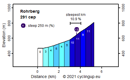
CyclingUp: Rohrberg
Climbing effort: 291 cep
Elevation meters: 345
Steepest kilometer: 10.9%
Steepest 250 m: 13%
Foot: 466 m Top: 809 m
Mean slope: 6.5%
Length: 5.3 km
From: Mambach
Road conditions (2017): good
Other race bikers: 1-5 per hour
Motor vehicles: <10 per hour
Scenery and road:
Restaurant or bar near top: no
PHOTOS Download gpx
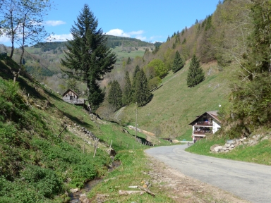
This is a magnificent, steep and short climb. The first three kilometers from Mambach to Rohmatt can be used to warm up (slope up to 5%). In Rohmatt we turn right and the party begins. Up to Rohrberg, there are still 233 elevation meters spread over a distance of 2.27 kilometers. So, on average the slope of this section measures 10.3%. There is almost no traffic on the road, the pavement is in good condition (2017) and the landscape is a pleasure. From Rohrberg you can continue further up to the Gersbacher Schwellen (1002 m). This results in 193 additional elevation meters and 170 climb effort points more. Unfortunately, beyond Rohrberg the road is unpaved.
Germania klimtocht
Rijd op 30 augustus deze prachtige klimtocht vanuit Wageningen over de Veluwe, door Montferland, Reichswald en Rijk van Nijmegen. Keuze uit 105 en 155 km met resp. 750 en 1130 hoogtemeters. Inschrijven vanaf 22 juni
Tour for Life
Rijdt deze zomer de unieke en klassieke 8-daagse wielrentocht van Noord-Italië naar Zuid-Nederland voor Artsen zonder Grenzen!